The city of Agroha was situated on the ancient trade route between Taxila and Mathura. And, therefore, it remained an important center of commerce and political activities till coming into existence of a new township of Hisar-e-Firoza (Hisar) of Firoz Shah Tughlag. A hoard of coins including 4 Indo Greek, one punch-marked and another 51 coins of Agrodaka were found from the site. The discovery of the coins of Agreya Janapada (Republic) during the excavations and its ancient name Agrodaka in literature are sufficient to prove it being the headquarters of a Republic. This site was excavated by C.J.Rodgers in 1888-89 and re-excavated by H.L.Srivastava in 1938-39 by Archaeological Survey of India to a depth of about 3.65 m. This site was further excavated by Shri P.K.Sharan and Shri J.S.Khatri of the Department of Archaeology & Museums, Government of Haryana in 1978-84.Archaeological excavation on this site revealed a fortified township and continuous habitation from 4th century BC to 14th century AD. Apart from the residential and community houses, made of baked bricks, the remains of a Buddhist stupa and a Hindu temple existing side by side indicated co-existence and respect of communal harmony.
This three-storied building is in the shape of a step-well. It is approached by descending flight of steps leading to the bottom of the well. The steps have thick wall on both the sides. The thick walls on the either side of the steps are decorated with close arched doorways .It was built by Bhai rulers (1767-1843) of Kaithal state for the use of the general public
The name Kalayat seems to be derived from Kapilayatana, meaning the ‘home of sage Kapila’, the preacher of Sankhya-darshan of Indian philosophy. But at present, only two such temples survive and they are dated to circa 8th century AD. Built from carved bricks with fine and thin mortar; these temples are good examples of early Hindu temple architecture and exhibit creative use of flower representative specimen of Gurjara-Pratijara style. Most striking features of these temples are the arrangements of the carved bricks. Out of the two surviving temples; one remains archaeologically better preserved; whereas the other one underwent heavy modifications. They are possibly the only surviving specimens of north Indian temple in this part of the country belonging to pre-Muslim era.
The history of Jind as a separate ruling state begins with 1763 AD. It is the first fort built by the rulers of Jind state who were the ancestors of Phulkian family. Afterwards, it was used as a military cantonment of the state. This fort has bastions for providing strength to the fortification, which were also used to ensure security. Traditionally, this town Safidon is connected with Mahabharata story and it is said that Janmejay, the son of Parikshit, and grandson of Arjuna. had performed ‘sarpyajna’ (snake-sacrificial ritual) at this place after the death of his father, who was bitten by a snake
Sher Bahlol was a celebrated saint and prophesied that Ghiyas-ud-din-Tughluq (1320-25 AD) would become the king of Delhi. All four sides of the tomb have arched openings. Its lower half portion is made out of dressed Kankar stone blocks and remaining upper half of Lakhauri bricks. The roof is surrounded by a low dome that rests on an octagonal drum. At present, there is no grave inside the tomb.
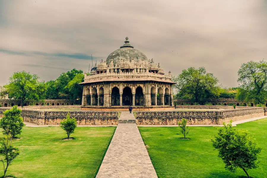
It is believed that this is the site of famous Chakravyuha, arranged by the Kauravas to fight with Pandavas. Abhimanyu, the son of Arjun had been trapped in this Chakravyuha and killed during Mahabharata war. The ancient site, in the shape of a mound, occupies an area of 650×250 m. with maximum height of 10 m. Two inscribed red sandstone pillars adorn with reliefs of Yaksha and other decorative motifs of Circa 2nd century BC were found here and at present are displayed in the Sculpture Gallery at National Museum, New Delhi.
This is an ancient site with an old well, which is believed to have belonged to Pandavas. They stayed here during their exile. Besides which, there is a temple of Kali Mata in this premises.
The site was situated on the southern bank of Rigvedic river, Saravati, about 4 kms. from village Siwan and 10 kms. from Kaithal. A small-scale archaeological excavation at this place has yielded antiquities of different periods, consisting of coins of Vasudeva and Yaudheyas dynasties, clay seals, weight, pottery, copper vessels etc. Shri Shankar Nath of Archaeological Survey of India also reported Painted Grey Ware during exploration of this site. Previously this site was known for the antiquities and coins of Indo-Greek period.
Asthal Bohar is stuated 6 to 7 kms. east of Rohtak city on Rohtak-Delhi N.H. 10, the place is known for its math and ancient finds like sculptured stone idols. After being neglected, the math was revived in 1791, when Baba Mast Nath came here. Now there is an Ayurvedic degree college, free hospital, Business Management Institute, engineering college and other institutions being run by the math.
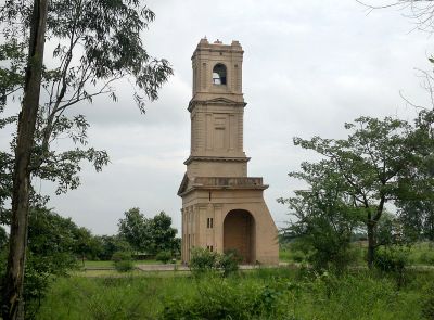
This huge gate presents a beautiful example of Sultanate architecture. Out of the five gates of walled ancient city of Hansi, this is the only one that survives as an ancient structure. It is a pointed arch gate. Subsequently, it was repaired in 1522 AD during the rule of Ibrahim Lodhi. This gateway, served in the ancient times as the main entrance to Hansi, is over 30 metres high.